Tiji Festival Mustang is an ancient Himalayan Kingdom which lies in the northern central part of Nepal and at the top of the Kaligandaki River. Upper Mustang c onsists of two distinct regions: the southern part and the northern where the languages, culture and traditions are alike to those of the Tibetan people. This area is consider as one of the most interesting and picturesque places in Nepal.
  The whole area has an isolated an...d mystical feel to it, enchanting and inspiring visitors to this region.
 onsists of two distinct regions: the southern part and the northern where the languages, culture and traditions are alike to those of the Tibetan people. This area is consider as one of the most interesting and picturesque places in Nepal.
  The whole area has an isolated an...d mystical feel to it, enchanting and inspiring visitors to this region.
The trek to Lo- Manthang is through high altitude desert country climbing in and out of the huge sided valley of the Kali Gandaki. In places the gorge which the Kali Gandaki River runs through is the deepest in the world. This region is full of some of Nepal's oldest Buddhist Monasteries, ancient and isolated villages with quaint white washed houses. Trek Highlights Explore the ancient Himalayan Kingdom, Interesting and picturesque villages, World Deepest gorge (Kaligandaki Valley) Buddhist monasteries,Ghompas and ancient Chortens, Ancient and isolated village near by tibetian plateau, Unique culture and Tradition. Tibetian Festival tiji,
*********************************************************************************
Day 1 21-May-11
Arrival at Kathmandu welcome and transfer to hotel Overnight at kthmandu Hotel.
Day 2 22-May-11 Seight seen tour in Kathmandu
Day 3 23-May-11 Drive or flight to Pokhara
Day 4 24-May-11
Pokhara-Jomsom-Kagbeni After an early breakfast transfer to the airport just 10 minutes from hotel for a morning flight to Jomsom, a super scenic flight of 20 minutes brings you at Jomsom, the district headquarter of Mustang. This is a large town, headquarter of the Mustang region; it is also a major village on the Kaligandaki area linking the age old Trans-Himalayan Salt Trade route to Tibet. From Jomsom onwards it is very windy in the afternoon, From Jomsom trek continues WITH THE HORSES on the gradual path on the Kali Gandaki river bed for about 3 hrs and finally reaching at Ekley-bhatti village. After good stop here an hour of easy walk reaches you to Kagbeni (2,858m/9,375ft), which lies at the bank of two rivers. Kagbeni, an interesting wind swept villages situated on the main age old Trans Himalayan salt trade route to Tibet via Upper Mustang area. On arrival, check in the hotel with afternoon free for a stroll around the village. Overnight at Hotel
Day 5 25-May-11
Kagbeni to Chele , Kagbeni is the entry point to upper Mustang. From Kagbeni, trail leads up the east bank of Kali Gandaki and climbs over many ridges as it head north. After, that, through the interesting cave, Gompa crossing place of Tangbe, Chhuksang and reaches Chele (3,030m). Walking time takes about 5/6 hours. Overnight at Hotel ,
Day 6 26-May-11
Chele to Gilling (3806 m.) From Chele, trail leads ascending to Samar. After that it climbs above Samar to a ridge, descends into a large gorge past a Chorten painted in red, black, yellow and white, all pigments made from local rock. From there one can enter another valley filled with juniper trees and drops to Bhena (3800m) and trail ascends goes to the place of Giling (3820m). Walking time takes approximately 6/7 hours, Overnight at hotel
Day 7 27-May-11
Gilling to Charang At the place of Geling, the trail climbs gently through field up the centre of the valley; it passes above Tama Gaon and its imposing Chorten. After crosses Tangmar Chu River, with a short climbing enters Charang (3490m). Walking time takes about 5/6 hours, Overnight at hotel,
Day 8 28-May-11 Tsarang to Lo Manthang Lomanthang is the capital city of upper Mustang. To reach Lomanthang (3,730m) from Charang, trail leads descending about 125m and climbs steeply up a rock trail through a desert like landscape.afternoon we will visit King Palace and Lo-mangthnag Walled city, Walking time takes about 3/4 hours. Overnight at hotel .
Day 9 29-May-11
Celebration of Tiji Festival (starting day) Early in the afternoon, horns resounded, announcing the two twelve-foot copper dunchens, with their elephantine blurting, followed by two double-reeled horns, all accompanied by drum and cymbals. Next, an ancient and enormous tanka three stories high was unrolled down the entire south wall of the square. The thanka portrayed Padma Sambhava or (Guru Rimpoche) who brought this ceremony to Tibet in the 8th century." At mid-afternoon, in high wind and blowing dust, eleven lamas in maroon and gold, wearing high red hats, came from the palace and took their places along the wall beneath the thanka, with Tashi Tenzing on the elevated seat just in the center. As the monks and lamas commence chanting, twelve more monks come from the palace in maroon and royal blue and glittering gold brocade, with cymbal-shaped hats decked with upright peacock plumes. Soon they withdraw, to be replaced by the masked dancers who" start the portrayal of the Tiji myth. Dorje Jono repels the demon through the power of his magical dancing - he dances fifty-two separate dances, one of them in ten different bodies, each with a different head. As the dances end, Dorje Jono kills the demon, after which his people are relieved of their plague of misfortunes, water becomes plentiful once more, and the balance and harmony of existence are restored. Overnight at hotel
Day 10 30-May-11
Celebration of Tiji Festival On the second day of Tiji, numbers of Loba have arrived from the outlying hamlets, and the small square is thronged with wild beautiful people, with all of the women and children, at least, in traditional dress. The King of Mustang, "wears a whole crown of tiny river pearls set off by dozens of large red coralline tones interspersed with matched ornaments of turquoise. The costumes and masks, the twelve-foot horns, the gold cups of wheat, the butter cakes, the snow peaks and wind and dust and sun, the mehti, snow leopard, snow pigeons, saligrams, the dying glacier and the desert ruins, the drunks and rajas and foreigners, the dogs and yaks. Tantra! Overnight at hotel .
Day 11 31-May-11
Celebration of Tiji Festival On the third day, Tiji ends with the ceremonial destruction of the evil remains, represented by some long black yak hair and red torma cakes minced to a dark red gurry. The demons red remnants are set out on an old tiger skin, where-upon they are attacked by bow and arrow, slings, and the old guns. The poor devils remains are over- turned upon the ground, each time to a wild cannonade from the old muzzle-loaders and a wave of cheers and smoke. Overnight at hotel
Day 12 1-Jun-11
Lo Mangthang – Ghami A slight variation of the return route heading south first from Lomanthang to Chorang, later turns east, to reach Lo Gekar (signifying 'Pure virtue of Lo' and also known as Ghar Gompa or house temple). The trail climbs steadily to a pass which is marked by a terrain, from where one can have a beautiful view of Lomanthang. From Lo Gekar the trek continues to reach a valley and then descends to village Ghami at 3440 m.O/n at hotel
Day 13 2-Jun-11
Ghami- Samar From Ghami a direct route is followed to Syangbochen.Climbing on a ridge the trek continues upward to meet the trails from Bhena and then descends to Samar. The trail retraces the track for the rest of the day with night at Samar. Overnight at hotel
Day 14 3-Jun-11
Samar to Kagbeni (2700m) Today, we will have a last day trek as well as long. It is better to walk early start as before and trek to Kagbeni finished the upper Mustang trails. Overnight at hotel
Day 15 4-Jun-11
Kagbeni- Jomsom After breakfast visit bank to Kaligandaki River a pilgrimage destination for Hindu people used to go there for puja with prist and walk along the trail to Jomsom. O/n at hotel
Day 16 5-Jun-11
Jomsom-Pokhara Jomsom-Pokhara Fly back to Pokhara (900m) in the morning and afternoon boating at phewa lake.and visiting the Rest and Sightseeing at Pokhara , Overnight at Hotel.
Day 17 6-Jun-11
Drive or flight to kathmandu
Day 18 7-Jun-11
full day seight seen in kathmandu
Day 19 8-Jun-11
Fly back to home
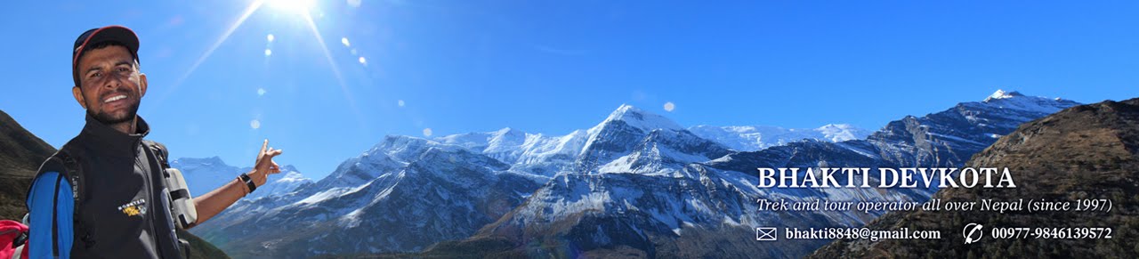
For Contact Detail
bhakti8848@gmail.com
009779846139572
http://nepal8848.blogspot.com/
*********************************************************************************
Day 1 21-May-11
Arrival at Kathmandu welcome and transfer to hotel Overnight at kthmandu Hotel.
Day 2 22-May-11 Seight seen tour in Kathmandu
Day 3 23-May-11 Drive or flight to Pokhara
Day 4 24-May-11
Pokhara-Jomsom-Kagbeni After an early breakfast transfer to the airport just 10 minutes from hotel for a morning flight to Jomsom, a super scenic flight of 20 minutes brings you at Jomsom, the district headquarter of Mustang. This is a large town, headquarter of the Mustang region; it is also a major village on the Kaligandaki area linking the age old Trans-Himalayan Salt Trade route to Tibet. From Jomsom onwards it is very windy in the afternoon, From Jomsom trek continues WITH THE HORSES on the gradual path on the Kali Gandaki river bed for about 3 hrs and finally reaching at Ekley-bhatti village. After good stop here an hour of easy walk reaches you to Kagbeni (2,858m/9,375ft), which lies at the bank of two rivers. Kagbeni, an interesting wind swept villages situated on the main age old Trans Himalayan salt trade route to Tibet via Upper Mustang area. On arrival, check in the hotel with afternoon free for a stroll around the village. Overnight at Hotel
Day 5 25-May-11
Kagbeni to Chele , Kagbeni is the entry point to upper Mustang. From Kagbeni, trail leads up the east bank of Kali Gandaki and climbs over many ridges as it head north. After, that, through the interesting cave, Gompa crossing place of Tangbe, Chhuksang and reaches Chele (3,030m). Walking time takes about 5/6 hours. Overnight at Hotel ,
Day 6 26-May-11
Chele to Gilling (3806 m.) From Chele, trail leads ascending to Samar. After that it climbs above Samar to a ridge, descends into a large gorge past a Chorten painted in red, black, yellow and white, all pigments made from local rock. From there one can enter another valley filled with juniper trees and drops to Bhena (3800m) and trail ascends goes to the place of Giling (3820m). Walking time takes approximately 6/7 hours, Overnight at hotel
Day 7 27-May-11
Gilling to Charang At the place of Geling, the trail climbs gently through field up the centre of the valley; it passes above Tama Gaon and its imposing Chorten. After crosses Tangmar Chu River, with a short climbing enters Charang (3490m). Walking time takes about 5/6 hours, Overnight at hotel,
Day 8 28-May-11 Tsarang to Lo Manthang Lomanthang is the capital city of upper Mustang. To reach Lomanthang (3,730m) from Charang, trail leads descending about 125m and climbs steeply up a rock trail through a desert like landscape.afternoon we will visit King Palace and Lo-mangthnag Walled city, Walking time takes about 3/4 hours. Overnight at hotel .
Day 9 29-May-11
Celebration of Tiji Festival (starting day) Early in the afternoon, horns resounded, announcing the two twelve-foot copper dunchens, with their elephantine blurting, followed by two double-reeled horns, all accompanied by drum and cymbals. Next, an ancient and enormous tanka three stories high was unrolled down the entire south wall of the square. The thanka portrayed Padma Sambhava or (Guru Rimpoche) who brought this ceremony to Tibet in the 8th century." At mid-afternoon, in high wind and blowing dust, eleven lamas in maroon and gold, wearing high red hats, came from the palace and took their places along the wall beneath the thanka, with Tashi Tenzing on the elevated seat just in the center. As the monks and lamas commence chanting, twelve more monks come from the palace in maroon and royal blue and glittering gold brocade, with cymbal-shaped hats decked with upright peacock plumes. Soon they withdraw, to be replaced by the masked dancers who" start the portrayal of the Tiji myth. Dorje Jono repels the demon through the power of his magical dancing - he dances fifty-two separate dances, one of them in ten different bodies, each with a different head. As the dances end, Dorje Jono kills the demon, after which his people are relieved of their plague of misfortunes, water becomes plentiful once more, and the balance and harmony of existence are restored. Overnight at hotel
Day 10 30-May-11
Celebration of Tiji Festival On the second day of Tiji, numbers of Loba have arrived from the outlying hamlets, and the small square is thronged with wild beautiful people, with all of the women and children, at least, in traditional dress. The King of Mustang, "wears a whole crown of tiny river pearls set off by dozens of large red coralline tones interspersed with matched ornaments of turquoise. The costumes and masks, the twelve-foot horns, the gold cups of wheat, the butter cakes, the snow peaks and wind and dust and sun, the mehti, snow leopard, snow pigeons, saligrams, the dying glacier and the desert ruins, the drunks and rajas and foreigners, the dogs and yaks. Tantra! Overnight at hotel .
Day 11 31-May-11
Celebration of Tiji Festival On the third day, Tiji ends with the ceremonial destruction of the evil remains, represented by some long black yak hair and red torma cakes minced to a dark red gurry. The demons red remnants are set out on an old tiger skin, where-upon they are attacked by bow and arrow, slings, and the old guns. The poor devils remains are over- turned upon the ground, each time to a wild cannonade from the old muzzle-loaders and a wave of cheers and smoke. Overnight at hotel
Day 12 1-Jun-11
Lo Mangthang – Ghami A slight variation of the return route heading south first from Lomanthang to Chorang, later turns east, to reach Lo Gekar (signifying 'Pure virtue of Lo' and also known as Ghar Gompa or house temple). The trail climbs steadily to a pass which is marked by a terrain, from where one can have a beautiful view of Lomanthang. From Lo Gekar the trek continues to reach a valley and then descends to village Ghami at 3440 m.O/n at hotel
Day 13 2-Jun-11
Ghami- Samar From Ghami a direct route is followed to Syangbochen.Climbing on a ridge the trek continues upward to meet the trails from Bhena and then descends to Samar. The trail retraces the track for the rest of the day with night at Samar. Overnight at hotel
Day 14 3-Jun-11
Samar to Kagbeni (2700m) Today, we will have a last day trek as well as long. It is better to walk early start as before and trek to Kagbeni finished the upper Mustang trails. Overnight at hotel
Day 15 4-Jun-11
Kagbeni- Jomsom After breakfast visit bank to Kaligandaki River a pilgrimage destination for Hindu people used to go there for puja with prist and walk along the trail to Jomsom. O/n at hotel
Day 16 5-Jun-11
Jomsom-Pokhara Jomsom-Pokhara Fly back to Pokhara (900m) in the morning and afternoon boating at phewa lake.and visiting the Rest and Sightseeing at Pokhara , Overnight at Hotel.
Day 17 6-Jun-11
Drive or flight to kathmandu
Day 18 7-Jun-11
full day seight seen in kathmandu
Day 19 8-Jun-11
Fly back to home
For Contact Detail
bhakti8848@gmail.com
009779846139572
http://nepal8848.blogspot.com/


